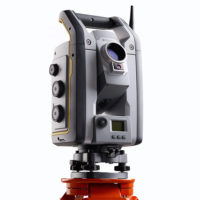
Description
Now you only need one instrument on the job site to perform all your data capture. Create 3D models, high accuracy visual site documentation, point clouds, and more using the Trimble S7, Trimble Access™ field software and Trimble Business Center office software.
- Surveying, imaging and 3D scanning in one powerful solution
- Improved Trimble VISION technology for video robotic control, scene documentation and photogrametric measurements
- Trimble DR Plus for long range and superior accuracy
- Complete field-to-office solution for quick data capture and processing
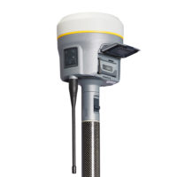
- Seamless integrated surveying with Trimble GNSS receivers
- Optional L2P services available